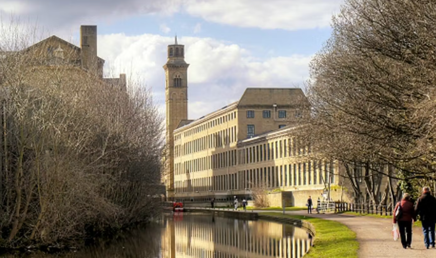
*Pateley Bridge, Yorkshire Dales*
SATURDAY, 8th August 2026
THE COACH WILL LEAVE PATELEY BRIDGE AT 5.30 PM
Some useful information about Pateley Bridge: Public toilets across from the car park are free of charge. Pubs – The Crown Inn and The Royal Oak. Cafes – The Courtyard Café and The Pancake House are both open until 5.00pm. There is also a fish and chip shop.
‘A’ (Strenuous) Leader: John O’Donohue
Distance: 12 miles 2,100 ft
Left out of the car park, up the road a wee bit, then up through Bewerley climbing to Strikes Wood. Nidderdale Way to Heyshaw, Dacre Banks and on to Summer Bridge. Here we take paths into Spring Woods followed by a bit of road work up to Brimham Rocks. From here we head to Mill House and on to Blazefield, and back to Pateley Bridge.
P.S. this is a hard 12 mile walk, so we may have to step it out.
o———-0———-o
‘B’ (Moderate) Leader: Donna Callaghan
Distance: 8.5 miles
Circular walk. 1303.ft (you can’t really go anywhere in Pateley Bridge without going uphill). Start from recreational play area/toilets. Up to Ladies Riggs, following Industrial Heritage Trail on to the Nidderdale Way. From Hillend to Brandstone Dub Bridge (lunch stop). On to Prosperous and Providence lead mines. Walking sticks are advisable here as we descend to the river because of the shale. Then on to Heathfield – Six Dales Trail. Following the River Nidd back to Pateley Bridge.
There is an opportunity to cut this short if weather is not good. But stunning views.
o———-o———-o
‘C’ (Easy) Leader: Sue Davies
Distance: 5.5 miles Total ascent 780 feet
A steady uphill climb to start with, taken at a gentle pace, making our way through fields and paths along the Nidderdale Way to Hillend. The views are spectacular. We skirt around a disused mine and cross a footbridge over Ashfold Side Beck. Following the beck, with great views again, we pass two caravan parks. Onto Foster Beck which feeds into the River Nidd. A pretty walk alongside the river leading into the park and back into Pateley Bridge.
Open pastures, gates, one stile, footbridges, mostly good tracks/paths.
‘D’ (Easy Amble): Jackie Gudgeon
Distance: 2.5-3 miles
After our customary stop for breakfast, we have a pleasant stroll along the River Nidd on good shady paths as far as Glasshouses. Over the other side of the river where we find a good spot for lunch and good rest before making our back to Pateley Bridge along fairly quiet lanes passing an equestrian centre, an Outdoors Centre and through Bewerley village.
Flat walk until just the end where we have a short stretch of easy uphill before dropping down again into Pateley Bridge. Good underfoot, a bit stony in parts along the river.
o———-o———-o
When available please make sure you read the notes on the walks carefully – they will help you to decide which walk will be the most suitable for you.
If you have any doubts, do not hesitate to ask the leader for advice. For the safety and enjoyment of yourself and others, please try not to join a walk which is beyond your capabilities.
Please respect the wishes of the walks leader and remain with the walk until the end. If you are struggling – inform the walk leader so that he/she can make a decision to shorten the walk, have more rest, etc
* Notes on the area *
When the Yorkshire Dales National Park was designated in 1954 it’s eastern boundary was drawn to exclude Nidderdale, presumably because most of the valley above Pateley Bridge and the surrounding watershed of the Nidd are associated with providing water for the City of Bradford, and as a result the reservoirs of Gouthwaite, Scar House and Angram impart a new element to the landscape which differentiates it from the other dales.
Pateley Bridge is the only route into Upper Nidderdale but it, and the small villages which surround it are well worth exploring. Tourists are well catered for and there are a number of well-appointed caravan sites. The Nidderdale Museum was opened in 1975. Run by local enthusiasts it occupies part of the former council offices opposite the parish church.
The name Pateley may derive from Pate, which is the old name for a badger, or perhaps from Patleia which means a path through the glade. Originally the main village was set high on the hillside near the ruined 14th century church of St Mary which was damaged during the Scots raids around 1318. In 1320 a market and a fair to be held on the Feast of St Mary was granted. This market has lapsed, but the Feast, the first Monday after the 17th September, is now the date of the Nidderdale Show, and the highlight of the year. The present Parish Church, built in the 19th century, is dedicated to St Cuthbert, but it does have on view a bell brought to the town when Fountains Abbey was dissolved in the late 1530s. This now has a place of honour in the body of the church and its Latin inscriptions are clearly legible.
A bridge at Pateley was first mentioned in 1320 but this would have been made of wood, the present structure being built in the 18th century but subsequently widened on the upstream side. Beyond it is a pleasant little park with a children’s playground, tennis courts and bowling greens, lending it an almost seaside atmosphere.
Brimham Rocks must be one of the most haunting geological formations to be found anywhere in the world – huge sandstone structures formed in desert conditions around 300 million years ago. Worn by wind and rain into fantastic shapes, the rocks have been given equally fantastic names including Indian’s Turban, Baboon’s Head, The Sphinx, Dancing Bear, Blacksmith and his anvil, and the Druid’s Writing Desk. When visitors first began exploring this heather-clad area, the legend grew that they had been carved by the Druids. There are well-marked paths running among the rocks and, next to the one called the Crocodile is Brimham House, now an information centre in which the local geology is explained. The 362 acre site is owned by the National Trust. From the trig point near Brimham House, 987 feet above sea level, there are splendid views, as well as many a stiff breeze. On a clear day one can see the Humber Estuary and York Minster.
o————0————o
* Coach Pick Up Points: *
Burscough War Memorial 8.20 am
Ormskirk Bus Station 8.30 am
Ormskirk School 8.30 am (ready for pickup)
Skelmersdale War Memorial 8.40 am
ASDA Bus stop 8.50 am (the coach will pick up at the bus stop on Northway near Asda – on the opposite side of the road to Bannatyne’s).
Upholland Labour Club 9.00 am
o————0————o
NEXT RAMBLE:
Saturday 12th September 2026. Bowness, Lake District